
Mapping the Potential: Siting Analysis
for Solar Photovoltaic Installation in Virginia

Intro
Virginia is currently the leading state in the U.S. for data centers, a rapidly growing sector that significantly increases statewide energy demand. To meet this demand sustainably, Virginia has committed to achieving net-zero carbon energy production by 2050. One viable strategy to help meet this goal is expanding the use of photovoltaic (PV) solar energy. However, large-scale solar development often requires the conversion of existing land cover, which can conflict with current land use priorities such as agriculture, conservation, and development.
This research investigates the solar potential of various land cover types in select Virginia counties, with the following objectives:
•Evaluate the suitability of different land types for PV deployment,
•Identify which land cover types offer the highest solar energy potential,
•Provide data to support informed decision-making by policymakers, planners, and industry stakeholders.
The results offer insights that can guide sustainable land use and energy infrastructure planning as Virginia works toward its clean energy targets.
Methodology
Obtain Datasets (DEM & Land Cover) and clip to counties
Use surface parameters to obtain aspect & slope raster layers
run raster solar radiation spatial analysis tool
Use aspect and slope raster layers to filter out undesired solar rasters
Run zonal statistics to obtain land cover area and mean radiation per land cover type
Calculate possible energy production
Results
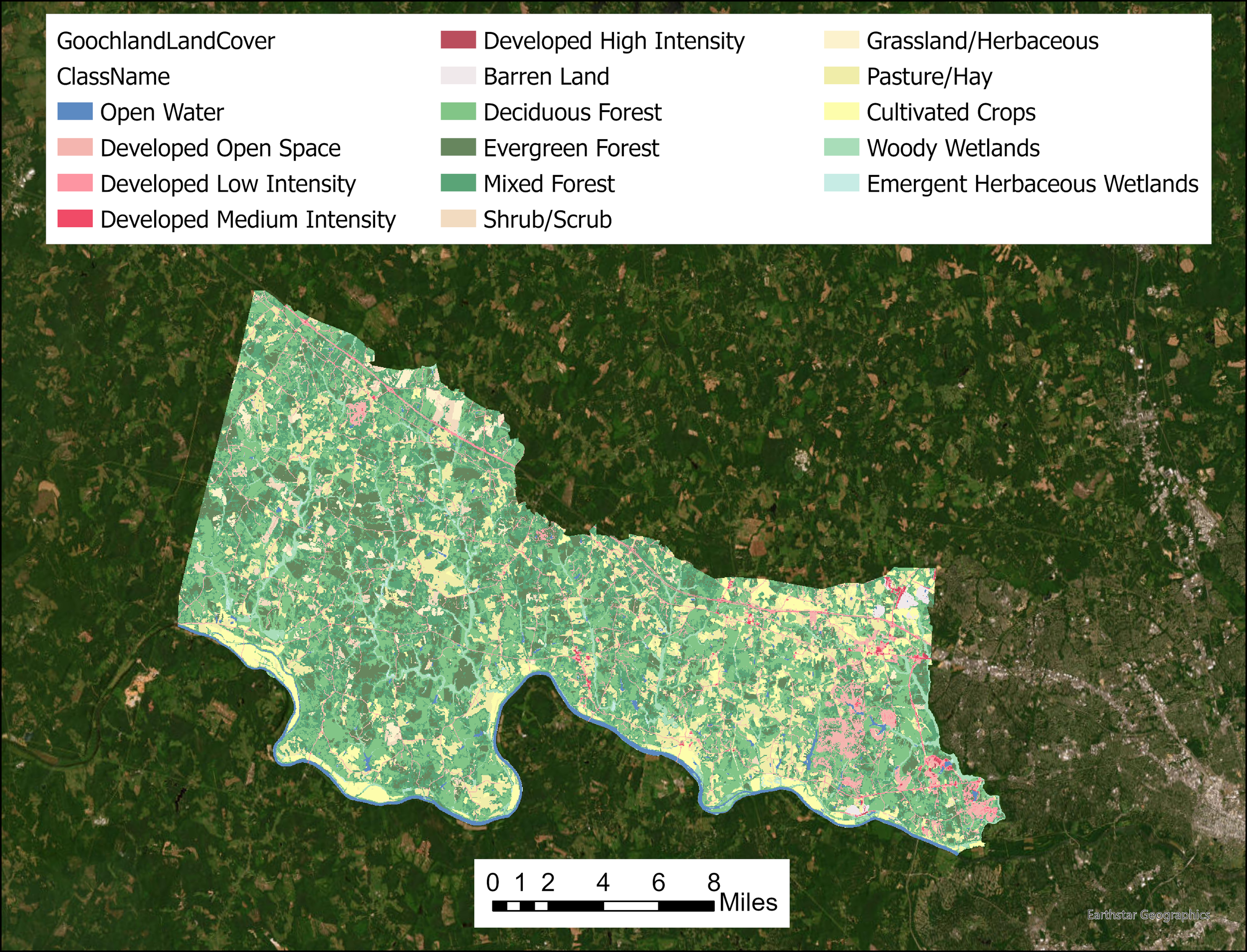
Land cover raster layer for Goochland County, VA

Solar radiation raster layer for Goochland County, VA

Analysis results for Goochland County, VA
Conclusion
This analysis relied on a Digital Elevation Model (DEM), which incorporates terrain elevation but does not account for surface features such as tree cover, buildings, or other obstructions to solar panel placement. A Digital Surface Model (DSM) would typically capture these features; however, the DEM was chosen with the assumption that existing land cover can be modified or cleared for photovoltaic (PV) development.
Key limitations and assumptions:
•DEM reflects bare-earth elevation only; actual shading or obstruction impacts are not captured.
•Assumes surface features (e.g., trees, buildings) can be removed or altered to accommodate solar infrastructure.
In Goochland County, results indicated that the highest average solar potential occurred in areas classified as Developed, High Intensity land cover. This is likely due to the presence of:
•Graded surfaces such as roads, parking lots, or cleared lots,
•Minimal shading from vegetation,
•Smoother, flatter terrain conducive to solar installations.
Advantages of using high-intensity developed areas for PV deployment:
•Land is already cleared—no land cover conversion required,
•Avoids competition with agricultural or ecologically sensitive land,
•Often offers easier access for construction and maintenance.
This study supports Virginia’s clean energy goals by identifying replicable methods for assessing local solar potential. Though applied to six counties, the analysis framework is scalable and adaptable across the state.
•The Model-Builder tool developed in ArcGIS consolidates all spatial analysis steps into one automated workflow.
•This tool enhances efficiency and enables broader application for state-wide solar suitability studies.